 |
Sugarloaf
is one of the small communities surrounding Big Bear Lake in San Bernardino County. The interesting name of Sugarloaf comes from the early settlement days when sugar was sold in pieces of a loaf. This tiny community is located inside the national forest and is home to a general store, tavern, tennis courts, a small park and several bed and breakfasts and country inns. Although the town itself is small, Sugarloaf is only four miles to all the excitement of Big Bear Lake. Just a sample of the activities in the area includes swimming, fishing, windsurfing and water skiing. Large and small boat rentals are available, as well as boat rides around the lake. There is also golf, tennis and horseback riding, and miles and miles of trails for hiking and biking. Wintertime brings alpine and cross-country skiing, snowboarding and sledding. The village of Big Bear Lake is a short drive from Sugarloaf and has world class restaurants and shopping, as well as a petting zoo and a water slide park. Sugarloaf is an excellent place to base your Big Bear Lake vacation. You will be near all the excitement, yet off the beaten track away from the noise and crowds.
Surrounding areas: Moonridge, California (1.6 mi), Big Bear Lake, California (4.3 mi), Angelus Oaks, California (11.1 mi), Forest Falls, California (11.8 mi), Running Springs, California (16.2 mi), Lake Arrowhead, California (20.8 mi), Banning, California (22.1 mi)
|

|
Sugarloaf Vacation Rentals
|

|
|
|
|
|
Sugarloaf Hotels and Resorts
|
|
|
| | | Hotels & Motels |
| Motel 6 | 42899 Big Bear Blvd | Big Bear Lake, CA | 2.5 mi. | (909) 585-6666 | | Holiday Inn-big Bear Chateau | 42200 Moonridge Rd | Big Bear Lake, CA | 2.8 mi. | (909) 866-6666 | | Lagonita Lodge | 183 Lagunita | Big Bear Lake, CA | 5.8 mi. | (909) 866-6531 | | Bracken Fern Manor | 815 Arrowhead Villas Rd | Lake Arrowhead, CA | 20.6 mi. | (909) 337-8557 | | Lake Arrowhead Hilton Resort | 27984 Hwy 189 | Lake Arrowhead, CA | 20.6 mi. | (714) 336-1511 | | Lake Arrowhead Resort | | Lake Arrowhead, CA | 20.6 mi. | (909) 336-1511 | | Saddleback Inn | 300 S State Hwy 173 | Lake Arrowhead, CA | 20.6 mi. | (714) 336-3571 | | Yu-cal Motel | 12163 14TH St | Yucaipa, CA | 21.1 mi. | (909) 797-8390 | | Calimesa Motor Lodge | 616 W Ave L | Calimesa, CA | 21.3 mi. | (909) 795-5084 | | Calimesa Inn | 1205 Calimesa Blvd | Calimesa, CA | 21.6 mi. | (909) 795-2536 | | Banning Super 8 Motel | 1690 W Ramsey St | Banning, CA | 22.3 mi. | (951) 849-6887 | | Morongo Casino Resort And Spa | 49500 Seminole Dr | Cabazon, CA | 22.3 mi. | (800) 252-4499 | | Days Inn-banning | 2320 W Ramsey St | Banning, CA | 22.4 mi. | (951) 849-0092 | | MT View Motel | 1430 E 6TH St | Beaumont, CA | 22.9 mi. | (951) 845-2986 | | Super 8 Motel Highland | 26667 Highland Ave | Highland, CA | 24.0 mi. | (909) 864-0100 | | Mission Lakes Inn | 8484 Clubhouse Blvd | Desert Hot SPGS, CA | 24.3 mi. | (760) 329-6481 | | Yucca Valley Super 8 Motel | 57096 Twentynine Palms Hwy | Yucca Valley, CA | 24.4 mi. | (760) 228-1773 | | Howard Johnson Inn | 1120 W Colton Ave | Redlands, CA | 24.6 mi. | (909) 793-2001 | | Comfort Suites | 1230 W Colton Ave | Redlands, CA | 24.7 mi. | (909) 335-9988 | | Dynasty Suites Redland | 1235 W Colton Ave | Redlands, CA | 24.7 mi. | (909) 793-6648 | | Motel 6 | 1160 Arizona St | Redlands, CA | 24.8 mi. | (909) 792-3175 | | Country Inn & Suites | 1650 Industrial Park Ave | Redlands, CA | 25.1 mi. | (909) 792-7913 | | Good Nite Inn Redlands | 1675 Industrial Park Ave | Redlands, CA | 25.1 mi. | (909) 793-3723 | | Days Inn-san Bernardino | 1386 E Highland Ave | San Bernardino, CA | 25.7 mi. | (909) 881-1702 | | Sunpark Lodge | 25300 3RD St | San Bernardino, CA | 26.1 mi. | (909) 884-2355 | | Motel 6 #1262 | | N Palm Springs, CA | 26.8 mi. | (619) 251-1425 | | University Inn Motel | 1914 S Tippecanoe Ave | San Bernardino, CA | 27.6 mi. | (909) 796-0254 | | Days Inn | 1909 S Business Ctr Dr | San Bernardino, CA | 27.9 mi. | (909) 889-0090 | | Guesthouse Inn | 1280 S East St | San Bernardino, CA | 27.9 mi. | (909) 888-0271 | | Super 8 Motel | 225 East Hosipitality Ln | San Bernardino, CA | 27.9 mi. | (909) 888-6777 | | San Bernardino Fairfield Inn & Suites | 1041 E Harriman Pl | San Bernardino, CA | 28.0 mi. | (909) 382-4560 | | San Bernardino Residence Inn | 1040 E Harriman Pl | San Bernardino, CA | 28.0 mi. | (909) 382-4564 | | Clarion Hotel & Conference Center | 295 N E St | San Bernardino, CA | 28.3 mi. | (909) 381-6181 | | Quality Inn | 1750 S Waterman Ave | San Bernardino, CA | 28.4 mi. | (909) 888-4827 | | Loma Linda Inn | 24532 University Ave | Loma Linda, CA | 28.5 mi. | (800) 796-6835 | | Econo Lodge | 606 N H St | San Bernardino, CA | 28.5 mi. | (909) 889-8717 | | Holiday Inn Express San Bernardino | 450 N G St | San Bernardino, CA | 28.5 mi. | (909) 885-0055 | | Best Western Hospitality Lane | 294 E Hospitality Ln | San Bernardino, CA | 28.6 mi. | (909) 381-1681 | | Sunshine Motel | 570 N H St | San Bernardino, CA | 28.6 mi. | (909) 888-1514 | | La Quinta Inn 570 | 205 E Hospitality Ln | San Bernardino, CA | 28.8 mi. | (909) 888-7571 |
| | | Bed & Breakfast |
| Apples Bed & Breakfast Inn | 42430 Moon RDG Rd | Big Bear Lake, CA | 4.7 mi. | (909) 866-0903 |

|
Sugarloaf Weather & Climate
|

|
|
|
The San Bernardino National Forest, near Big Bear Lake, is the only place in southern California that has four distinct seasons. At nearly 7,000 feet in elevation, the area enjoys warm, pleasant summers and crisp, cold winters. Its alpine tundra climate means plenty of snow in the wintertime for the ski slopes and occasional thunderstorms in spring and summer. The Big Bear Lake region also enjoys over 300 days of sunshine per year and is considered one of the sunniest places in the world. However, once the sun dips behind the mountains at night, it can be very cool - even in the middle of summer. The climate varies greatly from nearby Los Angeles. It can be 75 degrees in the city and 40 degrees in the mountains on the same day.
|
| Month |
High Temp |
Low Temp |
Rainfall |
Ocean Temp |
| January |
47°F |
20°F |
4.10 in. |
- |
| February |
48°F |
22°F |
4.60 in. |
- |
| March |
51°F |
24°F |
3.55 in. |
- |
| April |
58°F |
28°F |
0.95 in. |
- |
| May |
66°F |
34°F |
0.51 in. |
- |
| June |
75°F |
41°F |
0.18 in. |
- |
| July |
80°F |
47°F |
0.75 in. |
- |
| August |
79°F |
46°F |
0.98 in. |
- |
| September |
73°F |
40°F |
0.53 in. |
- |
| October |
64°F |
32°F |
0.78 in. |
- |
| November |
54°F |
25°F |
1.55 in. |
- |
| December |
47°F |
21°F |
2.67 in. |
- |

|
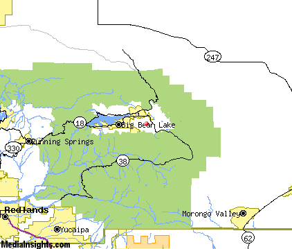
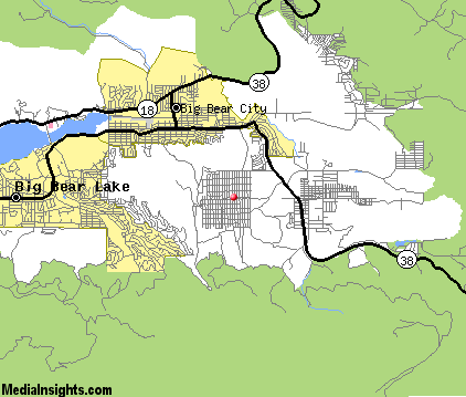
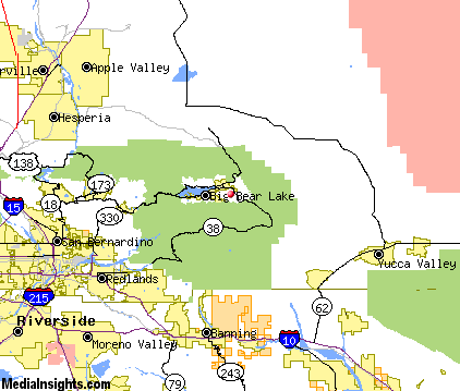
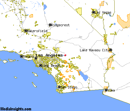
Sugarloaf Map & Transportation
|

|
|
 |
|
|
| Click each thumbnail image to enlarge. |
 |
|
 |
 |
The closest airports in the area are the San Bernardino International airport (SBD) located about 25 miles west of Sugarloaf in San Bernardino, California, the Apple Valley airport (APV) located approximately 30 miles northwest of Sugarloaf in Apple Valley, California, the Palm Springs International airport (PSP) located roughly 34 miles southeast of Sugarloaf in Palm Springs, California, and finally the Southern California Logistics airport (VCV) located around 39 miles northwest of Sugarloaf in Victorville, California.
|

|
Sugarloaf Attractions
|

|
|
| | | Amusement and Theme Parks |
| Pharaohs Lost Kingdom | Redlands | CA | 24.0 mi. | | | Castle Amusement Park | Riverside | CA | 38.1 mi. | | | Boomers Family Fun Center | Upland | CA | 47.9 mi. | | | Scandia Amusement Park | Ontario | CA | 48.6 mi. | | | Adventure City | Anaheim | CA | 68.3 mi. | | | Disney's California Adventure | Anaheim | CA | 68.3 mi. | | | Disneyland | Anaheim | CA | 68.3 mi. | | | Knott's Berry Farm | Buena Park | CA | 71.8 mi. | | | Legoland California | Carlsbad | CA | 80.8 mi. | | | Universal Studios Hollywood | Universal City | CA | 87.4 mi. | |
| | | Water Parks |
| Pharaoh's Waterpark | Redlands | CA | 24.0 mi. | | | Oasis Waterpark | Palm Springs | CA | 32.8 mi. | | | The Haunted Galleon and Volcano Island | Lake Elsinore | CA | 49.0 mi. | | | Raging Waters | San Dimas | CA | 56.7 mi. | | | Soak City U.S.A. | Buena Park | CA | 71.8 mi. | | | Six Flags Hurricane Harbor | Santa Clarita | CA | 98.3 mi. | | | Six Flags Hurricane Harbor | Valencia | CA | 102.5 mi. | |
| | | Golf Courses |
| Yucaipa Valley Golf Course | Yucaipa | CA | 19.1 mi. | | | Calimesa Country Club | Calimesa | CA | 21.4 mi. | | | Oak Valley Golf Club | Beaumont | CA | 22.4 mi. | | | Sun Lakes Country Club | Banning | CA | 22.5 mi. | | | Sun Lakes Country Club Executive Course | Banning | CA | 22.5 mi. | | | Blue Skies Country Club | Yucca Valley | CA | 22.8 mi. | | | PGA of Southern California at Oak Valley | Beaumont | CA | 23.8 mi. | | | Mission Lakes Country Club | Desert Hot Springs | CA | 24.4 mi. | | | Palm Meadows Golf Course | San Bernardino | CA | 25.9 mi. | | | Desert Crest Country Club | Desert Hot Springs | CA | 26.8 mi. | | | Jess Ranch Golf Course | Apple Valley | CA | 26.8 mi. | | | Sands RV Resort | Desert Hot Springs | CA | 26.8 mi. | | | Shandin Hills Golf Club | San Bernardino | CA | 27.7 mi. | | | San Bernardino Golf Club | San Bernardino | CA | 28.4 mi. | | | Hesperia Golf & Country Club | Hesperia | CA | 29.6 mi. | | | Desert Dunes Golf Course | Desert Hot Springs | CA | 29.9 mi. | | | Golden Era Golf Course | Gilman Hot Springs | CA | 29.9 mi. | |
| | | Ski Areas |
| Snow Valley | Running Springs | CA | 16.2 mi. | | | Ski Sunrise | Wrightwood | CA | 46.6 mi. | |
| | | State Parks |
| Heart Bar State Park | | CA | 8.1 mi. | | | Mount San Jacinto State Park | | CA | 31.3 mi. | |
| | | Museums |
| San Bernardino County Museum | Redlands | CA | 24.0 mi. | (History) | | Agua Caliente Cultural Museum | Palm Springs | CA | 32.8 mi. | (Miscellaneous) | | Palm Springs Air Museum | Palm Springs | CA | 32.8 mi. | (Miscellaneous) | | Riverside Municipal Museum | Riverside | CA | 38.1 mi. | (Multidisciplinary) | | Mojave River Valley Museum | Barstow | CA | 46.6 mi. | (History) | | Cooper Regional History Museum | Upland | CA | 47.9 mi. | (History) |
| | | Zoos and Aquariums |
| The Living Desert | Palm Desert | CA | 44.4 mi. | | | Birch Aquarium | La Jolla | CA | 65.6 mi. | | | Santa Ana Zoo | Santa Ana | CA | 68.7 mi. | | | Los Angeles Zoo | Los Angeles | CA | 82.0 mi. | | | San Diego Wild Animal Park | San Diego | CA | 107.3 mi. | | | San Diego Zoo | San Diego | CA | 107.3 mi. | | | Sea World of San Diego | San Diego | CA | 107.3 mi. | |
Notice a problem with the information on this page? Please notify us.
|
Disclaimer: We recommend you conduct your own research regarding all accomodations and attractions found on this website. The distances shown on this website are straight-line distances as the crow flies. The road distance may be considerably longer. You assume all liability for use of any information found on this website. No information is confirmed or warranted in any way. By using our services you agree to the terms and conditions of this disclaimer.
|
| We are the #1 site for your California Vacation presenting California vacation rentals, hotels, weather and map for each city. |
California Vacation and Hawaiian Vacation are publications and trademarks of Media Insights, Inc.
©1997-2025 All Rights Reserved.
|
|