 |
Hat-Creek
is a small, rural town located in Shasta County along scenic Highway 89 within the Lassen National Forest, approximately 70 minutes east of the city of Redding, and about 15 minutes from the town of Burney. This area was the location for the 1986 movie, "Stand By Me." Hat Creek Rim affords magnificent views of the Hat Creek Valley, which lies approximately 1,000 feet below, as well as views of Lassen Peak, Burney Mountain, and further away, Mount Shasta. Access to the rim is by dirt and gravel roads. This beautiful area is filled with gorgeous scenery and activities. Famous Hat Creek is clear and cold, and well known for its outstanding fishing and rafting. Other things to do in or nearby include hiking, swimming, wildlife viewing and birdwatching, picnicking, hang gliding off Hat Creek Rim, snowmobiling and cross-country skiing. Places to visit nearby include the Subway Underground Caves and the Thousand Lakes Wilderness Trailhead. Seven campgrounds and four picnic areas are found along Hat Creek, and the McArthur-Burney Falls Memorial State Park is just a short drive away on Highway 89. Shopping and dining can be found in the surrounding towns of Burney, Shingletown, Douglas City and Redding, and an easy day trip takes you to the spectacular Shasta/Cascade Wilderness Region.

|
Hat Creek Vacation Rentals
|

|
|
|
|
|
Hat Creek Hotels and Resorts
|
|
|
| | | Hotels & Motels |
| Shasta Pines Motel | 37386 Main St | Burney, CA | 8.4 mi. | (530) 335-2201 |

|
Hat Creek Weather & Climate
|

|
|
|
North Central California has sunny, hot summers and mild to cool winters. Located near the Mount Shasta/Shasta Trinity National Forest, this region's climate varies greatly according to elevation. Summers are usually hot and very dry with temperatures at the lower elevations sometimes climbing above the 100-degree mark. Higher elevations tend to have much cooler temperatures and higher precipitation in summer. Fall days are very pleasant with warm temperatures and cool nights. Winter is the rainy season at the lower elevations and snow in the higher elevations. Spring weather can be unstable with both rain and mild, sunny days. Visitors should exercise caution when traveling over the mountain passes - a mild day in the valley can change to much colder temperatures, and snow and ice in the wintertime, in the higher elevations.
|
| Month |
High Temp |
Low Temp |
Rainfall |
Ocean Temp |
| January |
47°F |
22°F |
2.96 in. |
- |
| February |
52°F |
25°F |
2.89 in. |
- |
| March |
57°F |
28°F |
2.82 in. |
- |
| April |
64°F |
32°F |
1.44 in. |
- |
| May |
72°F |
38°F |
1.36 in. |
- |
| June |
81°F |
43°F |
0.73 in. |
- |
| July |
89°F |
47°F |
0.21 in. |
- |
| August |
88°F |
44°F |
0.36 in. |
- |
| September |
82°F |
38°F |
0.79 in. |
- |
| October |
70°F |
31°F |
1.34 in. |
- |
| November |
54°F |
26°F |
2.33 in. |
- |
| December |
46°F |
21°F |
2.55 in. |
- |

|
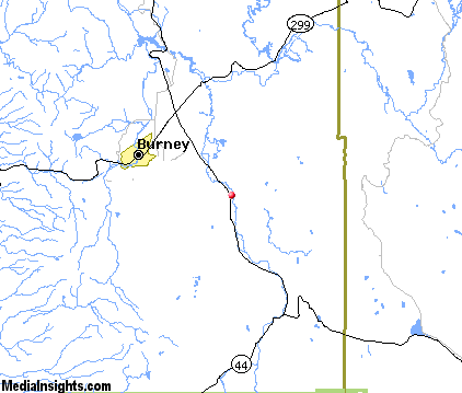
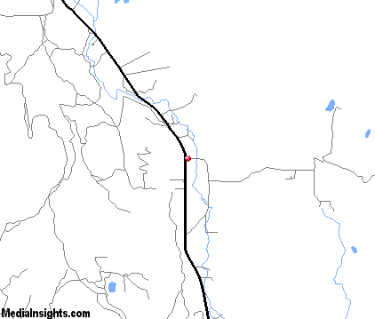
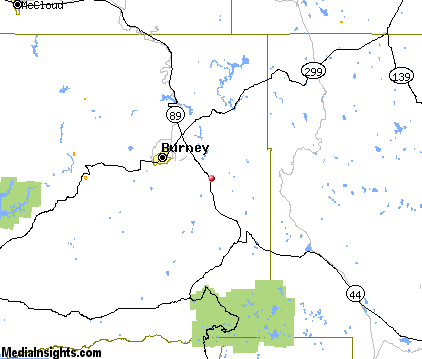
Hat Creek Map & Transportation
|

|
|
 |
|
|
| Click each thumbnail image to enlarge. |
 |
|
 |
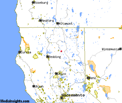 |
The closest airports in the area are Rogers Field (O05) located about 40 miles south of Hat Creek in Chester, California, the Redding Municipal airport (RDD) located approximately 46 miles west of Hat Creek in Redding, California, the Red Bluff Municipal airport (RBL) located roughly 60 miles southwest of Hat Creek in Red Bluff, California, the Weed airport (O46) located around 66 miles northwest of Hat Creek in Weed, California, and finally the Chico Municipal airport (CIC) located about 73 miles south of Hat Creek in Chico, California.
|
|
Hat Creek Attractions
|

|
|
| | | Water Parks |
| Waterworks Park | Redding | CA | 49.0 mi. | |
| | | Golf Courses |
| Fall River Valley Golf & Country Club | Fall River Mills | CA | 12.5 mi. | |
| | | Ski Areas |
| Mount Shasta Ski Park | Shasta | CA | 53.7 mi. | | | Mount Ashland | Ashland | OR | 112.8 mi. | |
| | | State Parks |
| McArthur-Burney Falls Memorial State Park | | CA | 14.3 mi. | | | Ahjumawi Lava Springs State Park | | CA | 21.4 mi. | |
| | | Museums |
| UCLA Fowler Museum of Cultural History | Westwood | CA | 45.0 mi. | (History) | | Herb Lane Museum | Redding | CA | 49.0 mi. | (Art) | | Redding Museum of Art and History | Redding | CA | 49.0 mi. | (Art) |
Notice a problem with the information on this page? Please notify us.
|
Disclaimer: We recommend you conduct your own research regarding all accomodations and attractions found on this website. The distances shown on this website are straight-line distances as the crow flies. The road distance may be considerably longer. You assume all liability for use of any information found on this website. No information is confirmed or warranted in any way. By using our services you agree to the terms and conditions of this disclaimer.
|
| We are the #1 site for your California Vacation presenting California vacation rentals, hotels, weather and map for each city. |
California Vacation and Hawaiian Vacation are publications and trademarks of Media Insights, Inc.
©1997-2025 All Rights Reserved.
|
|