
|
Fall River Mills Vacation Rentals
|

|
|
|
|
|
Fall River Mills Hotels and Resorts
|
|
|
| | | Hotels & Motels |
| Shasta Pines Motel | 37386 Main St | Burney, CA | 13.9 mi. | (530) 335-2201 |

|
Fall River Mills Weather & Climate
|

|
|
|
North Central California has sunny, hot summers and mild to cool winters. Located near the Mount Shasta/Shasta Trinity National Forest, this region's climate varies greatly according to elevation. Summers are usually hot and very dry with temperatures at the lower elevations sometimes climbing above the 100-degree mark. Higher elevations tend to have much cooler temperatures and higher precipitation in summer. Fall days are very pleasant with warm temperatures and cool nights. Winter is the rainy season at the lower elevations and snow in the higher elevations. Spring weather can be unstable with both rain and mild, sunny days. Visitors should exercise caution when traveling over the mountain passes - a mild day in the valley can change to much colder temperatures, and snow and ice in the wintertime, in the higher elevations.
|
| Month |
High Temp |
Low Temp |
Rainfall |
Ocean Temp |
| January |
47°F |
22°F |
2.73 in. |
- |
| February |
52°F |
25°F |
2.73 in. |
- |
| March |
57°F |
28°F |
2.67 in. |
- |
| April |
64°F |
32°F |
1.43 in. |
- |
| May |
72°F |
38°F |
1.41 in. |
- |
| June |
81°F |
43°F |
0.71 in. |
- |
| July |
89°F |
47°F |
0.15 in. |
- |
| August |
88°F |
44°F |
0.32 in. |
- |
| September |
82°F |
38°F |
0.79 in. |
- |
| October |
70°F |
31°F |
1.41 in. |
- |
| November |
54°F |
26°F |
2.20 in. |
- |
| December |
46°F |
21°F |
2.33 in. |
- |

|
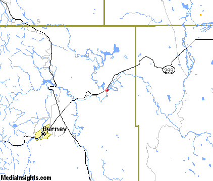
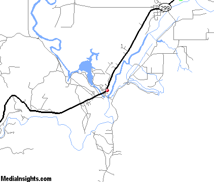
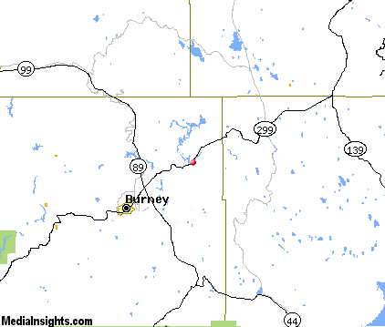
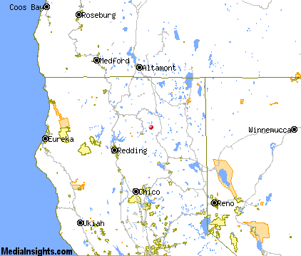
Fall River Mills Map & Transportation
|

|
|
 |
|
|
| Click each thumbnail image to enlarge. |
 |
|
 |
 |
The closest airports in the area are Rogers Field (O05) located about 50 miles south of Fall River Mills in Chester, California, the Redding Municipal airport (RDD) located approximately 56 miles southwest of Fall River Mills in Redding, California, the Weed airport (O46) located roughly 61 miles northwest of Fall River Mills in Weed, California, the Red Bluff Municipal airport (RBL) located around 72 miles southwest of Fall River Mills in Red Bluff, California, and finally the Siskiyou County airport (SIY) located about 75 miles northwest of Fall River Mills in Montague, California.
|

|
Fall River Mills Attractions
|

|
|
| | | Water Parks |
| Waterworks Park | Redding | CA | 57.6 mi. | |
| | | Golf Courses |
| Fall River Valley Golf & Country Club | Fall River Mills | CA | | |
| | | Ski Areas |
| Mount Shasta Ski Park | Shasta | CA | 61.8 mi. | | | Mount Ashland | Ashland | OR | 105.2 mi. | |
| | | State Parks |
| Ahjumawi Lava Springs State Park | | CA | 8.8 mi. | | | McArthur-Burney Falls Memorial State Park | | CA | 11.1 mi. | |
| | | Museums |
| UCLA Fowler Museum of Cultural History | Westwood | CA | 53.3 mi. | (History) | | Herb Lane Museum | Redding | CA | 57.6 mi. | (Art) | | Redding Museum of Art and History | Redding | CA | 57.6 mi. | (Art) |
Notice a problem with the information on this page? Please notify us.
|
Disclaimer: We recommend you conduct your own research regarding all accomodations and attractions found on this website. The distances shown on this website are straight-line distances as the crow flies. The road distance may be considerably longer. You assume all liability for use of any information found on this website. No information is confirmed or warranted in any way. By using our services you agree to the terms and conditions of this disclaimer.
|
| We are the #1 site for your California Vacation presenting California vacation rentals, hotels, weather and map for each city. |
California Vacation and Hawaiian Vacation are publications and trademarks of Media Insights, Inc.
©1997-2025 All Rights Reserved.
|
|