 |
Sequoia
is part of the Visalia-Tulare-Porterville metropolitan area in Tulare County in central California. The Sequoia National Forest covers an enormous area from the Kings River going southward to the Kern River and Piute Mountains and extends from the western Sierra Nevada foothills to the brush covered hills of the San Joaquin Valley. Just north of Sequoia lies the Kings Canyon National Forest and together both parks cover 865,000 acres. The most impressive attraction in the area is the trees, including the General Sherman Tree, which is the oldest living thing on Earth. Beautiful mountain scenery, unspoiled creeks and rivers, lakes and flowering meadows make up the rest of the terrain. White water rafting is popular on both the Kings and Kern Rivers, and there are over 800 miles of marked trails for hikers in the area! Other outdoors recreation includes swimming, fishing, boating, horseback riding and rock climbing. Wintertime offers opportunities for cross-country skiing, snowshoeing and sledding. Wuksachi Village is one of the newest attractions to the area and consists of a group of buildings made of cedar and stone and includes a lodge, full service restaurant and lounge, meeting and conference space, gift shop and 102 guestrooms. Sequoia offers outdoor fun and excitement and peaceful solitude for those seeking the tranquility only nature provides.

|
Sequoia Vacation Rentals
|

|
|
|
|
|
Sequoia Hotels and Resorts
|
|
|
| | | Hotels & Motels |
| Best Western Exeter Inn & Suites | 805 S Kaweah Ave | Exeter, CA | 9.7 mi. | (559) 592-8118 | | Best Western Holiday Lodge | 40105 Sierra Dr | Three Rivers, CA | 10.8 mi. | (559) 561-4119 | | Comfort Inn At Sequoia National Park | 40820 Sierra Dr | Three Rivers, CA | 11.2 mi. | (559) 561-9000 | | Comfort Suites Sequoia Park | 210 E Acequia Ave | Visalia, CA | 11.9 mi. | (559) 738-1700 | | Marriott Visalia | 300 S Court St | Visalia, CA | 12.0 mi. | (559) 636-1111 | | Best Western Inn | 623 W Main St | Visalia, CA | 12.2 mi. | (559) 732-4561 | | Econo Lodge | 1400 S Mooney Blvd | Visalia, CA | 13.9 mi. | (559) 732-6641 | | Days Inn | 4645 W Noble Ave | Visalia, CA | 14.6 mi. | (559) 732-5611 | | Fairfield Inn By Marriott | 140 South Akers St | Visalia, CA | 14.7 mi. | (559) 636-7600 | | Olive Tree Inn | 390 N Hwy 65 | Lindsay, CA | 15.6 mi. | (559) 562-5188 | | Holiday Inn | 9000 W Airport Dr | Visalia, CA | 16.8 mi. | (559) 651-5000 | | Comfort Inn & Suites-Visalia | 9300 W Airport Dr | Visalia, CA | 17.0 mi. | (559) 651-3700 | | Best Western Americana | 1450 South Alta | Dinuba, CA | 17.3 mi. | (800) 528-1234 | | Charter Inn & Suites | 1016 E Prosperity Ave | Tulare, CA | 18.5 mi. | (559) 685-9500 | | Quality Inn | 1010 E Prosperity Ave | Tulare, CA | 18.5 mi. | (559) 686-3432 | | Best Western Town And Country Inn | 1051 N Blackstone | Tulare, CA | 18.6 mi. | (888) 488-5273 | | Comfort Suites | 1021 N Blackstone Ave | Tulare, CA | 18.6 mi. | (559) 687-1246 | | Days Inn | 1183 N Blackstone St | Tulare, CA | 18.6 mi. | (559) 686-0985 | | Motel 6 #264 | 111 N Blackstone | Tulare, CA | 19.2 mi. | (559) 686-1611 | | Wuksachi Lodge | 64740 Wuksachi Way | Sequoia Natl PK, CA | 20.6 mi. | (559) 565-4070 | | Howard Johnson Express Inn | 1050 E Rankin Rd | Tulare, CA | 22.5 mi. | (559) 688-6671 | | Montecito-sequoia Lodge | 8000 General's Hwy | Kings Canyon, CA | 22.9 mi. | (559) 565-3388 | | John Muir Lodge-granst Grove Village | Hwy 180 | Kings Cyn Matl PK, CA | 22.9 mi. | (559) 335-5500 | | Sequoia Motel | 733 N Main St | Porterville, CA | 24.7 mi. | (559) 784-6175 | | Motel 6 | 935 W Morton | Porterville, CA | 24.9 mi. | (559) 781-7600 | | Paul Bunyan Lodge | 940 W Morton Ave | Porterville, CA | 24.9 mi. | (559) 784-3150 | | Best Western Porterville Inn | 350 W Montgomery Ave | Porterville, CA | 26.6 mi. | (559) 781-7411 |

|
Sequoia Weather & Climate
|

|
|
|
The heart of the Central San Joaquin Valley of California, approximately halfway between San Francisco and Los Angeles, has generally mild weather throughout the year. Summers are hot and dry and winters are mild and cool. Elevations above 5,000 feet, near the Sequoia and Kings Canyon National Forests can experience snow from November through March. The lower regions experience precipitation in the form of rain during these months, and lingering fog can sometimes be a problem. The lower valley region is known as the number one agricultural region in the world, where over 250 different crops are grown on one million irrigated acres. The mean number of clear days in this region number 201 with 29 mean days of precipitation. There are 2 average mean days of snow with an annual snowfall of 8 inches.
|
| Month |
High Temp |
Low Temp |
Rainfall |
Ocean Temp |
| January |
57°F |
37°F |
2.80 in. |
- |
| February |
64°F |
41°F |
2.53 in. |
- |
| March |
69°F |
44°F |
2.98 in. |
- |
| April |
76°F |
47°F |
1.10 in. |
- |
| May |
85°F |
52°F |
0.54 in. |
- |
| June |
93°F |
58°F |
0.16 in. |
- |
| July |
98°F |
63°F |
0.01 in. |
- |
| August |
97°F |
61°F |
0.04 in. |
- |
| September |
91°F |
57°F |
0.33 in. |
- |
| October |
81°F |
50°F |
0.76 in. |
- |
| November |
67°F |
41°F |
1.56 in. |
- |
| December |
57°F |
36°F |
1.75 in. |
- |

|
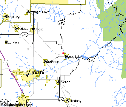
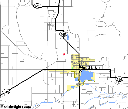
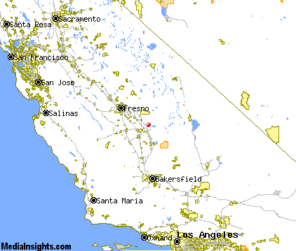
Sequoia Map & Transportation
|

|
|
 |
|
|
| Click each thumbnail image to enlarge. |
 |
|
 |
 |
The closest airports in the area are the Visalia Municipal airport (VIS) located about 17 miles west of Sequoia in Visalia, California, the Porterville Municipal airport (PTV) located approximately 27 miles south of Sequoia in Porterville, California, the Fresno Yosemite International airport (FAT) located roughly 41 miles northwest of Sequoia in Fresno, California, the Delano Municipal airport (DLO) located around 47 miles south of Sequoia in Delano, California, the Madera Municipal airport (MAE) located about 67 miles northwest of Sequoia in Madera, California, and finally Meadows Field (BFL) located approximately 68 miles south of Sequoia in Bakersfield, California.
|

|
Sequoia Attractions
|

|
|
| | | Amusement and Theme Parks |
| Blackbeard's Family Entertainment Center | Fresno | CA | 42.6 mi. | | | Rotary Playland | Fresno | CA | 42.6 mi. | |
| | | Water Parks |
| Wild Water Adventures | Clovis | CA | 42.6 mi. | | | The Island Waterpark and Family Fun Village | Fresno | CA | 42.6 mi. | |
| | | Golf Courses |
| Exeter Public Golf Course | Exeter | CA | 9.6 mi. | | | Three Rivers Golf Course | Three Rivers | CA | 11.2 mi. | | | Oak Patch Golf Course | Visalia | CA | 11.8 mi. | | | Valley Oaks Golf Club | Visalia | CA | 11.8 mi. | | | Sierra View Golf Course | Visalia | CA | 13.7 mi. | | | Lindsay Municipal Golf Course | Lindsay | CA | 15.9 mi. | | | Tulare Golf Course | Tulare | CA | 20.1 mi. | | | Porterville Municipal Golf Course | Porterville | CA | 25.9 mi. | | | Selma Valley Golf Course | Selma | CA | 29.1 mi. | |
| | | Ski Areas |
| Mammoth Mountain | Mammoth Lakes | CA | 84.8 mi. | | | June Mountain | June Lake | CA | 93.5 mi. | |
| | | Museums |
| Ruth and Sherman Lee Institute for Japanese Art at the Clark Center | Hanford | CA | 30.2 mi. | (Art) | | Fresno Metropolitan Museum | Fresno | CA | 42.6 mi. | (Multidisciplinary) | | Fresno Art Museum | Fresno | CA | 42.6 mi. | (Art) |
| | | Zoos and Aquariums |
| Chaffee Zoological Gardens | Fresno | CA | 42.6 mi. | | | Charles Paddock Zoo | Atascadero | CA | 108.4 mi. | |
Notice a problem with the information on this page? Please notify us.
|
Disclaimer: We recommend you conduct your own research regarding all accomodations and attractions found on this website. The distances shown on this website are straight-line distances as the crow flies. The road distance may be considerably longer. You assume all liability for use of any information found on this website. No information is confirmed or warranted in any way. By using our services you agree to the terms and conditions of this disclaimer.
|
| We are the #1 site for your California Vacation presenting California vacation rentals, hotels, weather and map for each city. |
California Vacation and Hawaiian Vacation are publications and trademarks of Media Insights, Inc.
©1997-2025 All Rights Reserved.
|
|