 |
Cayucos
is a laid back California beach town located along the central coast about halfway between San Francisco and Los Angeles. Cayucos has miles of shoreline to stroll and search for driftwood and explore tidepools, or to watch the sun slip silently into the sea. Year round mild weather makes Cayucos ideal for swimming, skin diving, surfing and sea kayaking. Cayucos Beach has a children's play area and a lifeguard in summertime, as well as picnic areas and barbecues. You can fish off the pier, or rent a boat and go deep-sea fishing. Cayucos is known for their antiques shops, and holds several antiques and collectibles street fairs every year. The downtown area is also home to many fine restaurants, gift shops, and candy and ice cream stores. Nearby attractions include the Paso Robles vineyards, the spectacular Hearst Castle, majestic Morro Rock and the colorful town of Cambria are all just a short drive away. Cayucos has vacation rentals, as well as numerous seaside hotels and bed and breakfasts, including a unique New England style residence built by a ship's captain in the 1880s. This is a place to slow down, breathe in the fresh ocean air and relax. The charm and natural beauty of Cayucos will soon soothe your cares away!
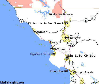
Surrounding areas: Morro Bay, California (4.6 mi), Baywood Park, California (8.4 mi), Los Osos, California (9.0 mi), Cambria, California (13.7 mi), Atascadero, California (14.0 mi), San Luis Obispo, California (17.1 mi), Paso Robles, California (17.2 mi)
|

|
Cayucos Vacation Rentals
|

|
|
|
|
|
Cayucos Hotels and Resorts
|
|
|
| | | Hotels & Motels |
| Beachwalker Inn | 501 S Ocean Ave | Cayucos, CA | | (805) 995-2133 | | El Ranch Best Western | 2460 Main St | Morro Bay, CA | 4.1 mi. | (805) 772-2212 | | Motel 6 | 298 Atascadero Rd | Morro Bay, CA | 4.5 mi. | (805) 772-5641 | | Days Inn Harbor House | 1095 Main St | Morro Bay, CA | 5.3 mi. | (800) 247-5076 | | Econo Lodge | 1100 Main St | Morro Bay, CA | 5.3 mi. | (805) 772-5609 | | Blue Sail Inn | 851 Market Ave | Morro Bay, CA | 5.4 mi. | (805) 772-7132 | | Ascot Suites | 260 Morro Bay Blvd | Morro Bay, CA | 5.5 mi. | (805) 772-4437 | | Bay View Lodge | 225 HBR St | Morro Bay, CA | 5.5 mi. | (805) 772-2771 | | Best Western San Marcos Motor Inn | 250 Pacific St | Morro Bay, CA | 5.5 mi. | (805) 772-2248 | | The Inn At Morro Bay | 19 Country CLB Rd | Morro Bay, CA | 5.5 mi. | (805) 772-5651 | | Embarcadero Inn | 456 Embarcadero | Morro Bay, CA | 5.7 mi. | (805) 772-2700 | | Inn At Morro Bay | 60 State Park Rd | Morro Bay, CA | 6.4 mi. | (805) 772-5651 | | Blue Heron | 1899 9TH St | Los Osos, CA | 9.0 mi. | (805) 528-1493 | | Best Western Colony Inn | 3600 El Camino Real | Atascadero, CA | 12.3 mi. | (805) 466-4449 | | Cambria Pines Lodge | 2905 Burton Dr | Cambria, CA | 13.5 mi. | (805) 927-4200 | | Motel 6 #351 | 9400 El Camino Real | Atascadero, CA | 13.7 mi. | (805) 466-6701 | | Best Western Fireside Inn | 6700 Moonstone Beach | Cambria, CA | 13.7 mi. | (805) 927-8661 | | Burton Drive Inn - Sylvia's | 4022 Burton Dr | Cambria, CA | 13.7 mi. | (805) 927-5125 | | Creekside Inn | 2618 Main St | Cambria, CA | 13.7 mi. | (805) 927-4021 | | White Water Inn | 6790 Moonstone BCH Dr | Cambria, CA | 13.7 mi. | (805) 927-1066 | | Econo Lodge | 950 Olive St | San Luis Obispo, CA | 16.5 mi. | (805) 544-8886 | | Ramada Inn-San Luis Obispo | 1000 Olive St | San Luis Obispo, CA | 16.5 mi. | (800) 777-5847 | | Travelodge Downtown | 345 Marsh St | San Luis Obispo, CA | 16.9 mi. | (805) 543-6443 | | Apple Farm Inn | 2015 Monterey St | San Luis Obispo, CA | 17.0 mi. | (805) 544-1317 | | Best Western Somerset Inn | 1895 Monterey St | San Luis Obispo, CA | 17.0 mi. | (805) 544-0973 | | Comfort Inn & Suites Lamplighter | 1604 Monterey St | San Luis Obispo, CA | 17.0 mi. | (805) 547-7777 | | Days Inn | 2050 Garfield St | San Luis Obispo, CA | 17.0 mi. | (805) 549-9911 | | Holiday Inn Express | 1800 Monterey St | San Luis Obispo, CA | 17.0 mi. | (805) 544-8600 | | La Cuesta Motor Inn | 2074 Monterey St | San Luis Obispo, CA | 17.0 mi. | (805) 543-2777 | | Quality Suites | 1631 Monterey St | San Luis Obispo, CA | 17.0 mi. | (805) 541-5001 | | Sands Suites & Motel | 1930 Monterey St | San Luis Obispo, CA | 17.0 mi. | (805) 544-0500 | | Super 8 Motel | 1951 Monterey St | San Luis Obispo, CA | 17.0 mi. | (805) 544-7895 | | Travelodge | 1825 Monterey St | San Luis Obispo, CA | 17.0 mi. | (805) 543-5110 | | Best Western Royal Oak Motor Hotel | 214 Madonna Rd | San Luis Obispo, CA | 17.1 mi. | (805) 544-4410 | | Embassy Suites Hotel San Luis Obispo | 333 Madonna Rd | San Luis Obispo, CA | 17.1 mi. | (805) 549-0800 | | Adelaide Motor Inn | 1215 Ysabell Ave | Paso Robles, CA | 17.2 mi. | (805) 238-2770 | | Hampton Inn & Suites | 212 Alexa Court | Paso Robles, CA | 17.2 mi. | (805) 226-9988 | | La Bellasera Hotel & Suites | 206 Alexa Ct | Paso Robles, CA | 17.2 mi. | (805) 238-2834 | | Travelodge Paso Robles | 2701 SPG St | Paso Robles, CA | 17.2 mi. | (805) 238-0078 | | Motel 6 #138 | 1433 Calle Joaquin | San Luis Obispo, CA | 17.7 mi. | (805) 549-9595 |

|
Cayucos Weather & Climate
|

|
|
|
Very mild weather all year long, similar to a Mediterranean climate, is what you'll find along the south-central coast of California. Located between Monterey County and Santa Barbara, this area of the coast enjoys almost ideal weather and over 300 days of sunshine per year. The terrain is made up of gently rolling hills and sand dunes, lush foliage and vineyards. It is known to have some of the best weather on the Central Coast. Cool ocean breezes keep temperatures from becoming too hot in the summer and the latitude and oceanic effects keeps things mild in winter. Low clouds and patchy fog are often reported often on summer days, but it almost always burns off by noontime. Precipitation in the form of rain falls November through March.
|
| Month |
High Temp |
Low Temp |
Rainfall |
Ocean Temp |
| January |
61°F |
42°F |
3.49 in. |
54°F |
| February |
62°F |
43°F |
3.69 in. |
54°F |
| March |
62°F |
44°F |
3.66 in. |
54°F |
| April |
63°F |
45°F |
1.12 in. |
54°F |
| May |
62°F |
47°F |
0.34 in. |
54°F |
| June |
64°F |
50°F |
0.07 in. |
56°F |
| July |
65°F |
52°F |
0.03 in. |
57°F |
| August |
66°F |
53°F |
0.09 in. |
58°F |
| September |
67°F |
52°F |
0.37 in. |
58°F |
| October |
68°F |
49°F |
0.70 in. |
57°F |
| November |
66°F |
45°F |
1.54 in. |
56°F |
| December |
62°F |
41°F |
2.51 in. |
55°F |

|
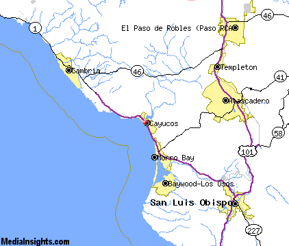
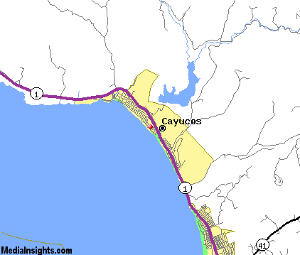
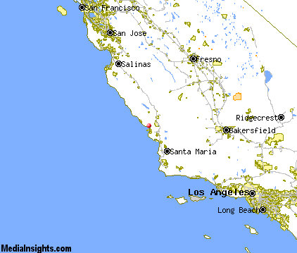
Cayucos Map & Transportation
|

|
|
 |
|
|
| Click each thumbnail image to enlarge. |
 |
|
 |
 |
The closest airports in the area are the San Luis County Regional airport (SBP) located about 19 miles southeast of Cayucos in San Luis Obispo, California, the Paso Robles Municipal airport (PRB) located approximately 21 miles northeast of Cayucos in Paso Robles, California, the Santa Maria Pub Cpt G Allan Hancock airport (SMX) located roughly 44 miles southeast of Cayucos in Santa Maria, California, and finally the New Coalinga Municipal airport (C80) located around 60 miles northeast of Cayucos in Coalinga, California.
|

|
Cayucos Attractions
|

|
|
| | | Water Parks |
| The Island Waterpark and Family Fun Village | Fresno | CA | 110.0 mi. | | | Wild Water Adventures | Clovis | CA | 116.6 mi. | |
| | | Golf Courses |
| Morro Bay Golf Course | Morro Bay | CA | 4.6 mi. | | | Eagle Creek Golf Course | Atascadero | CA | 13.3 mi. | | | Chalk Mountain Golf Course | Atascadero | CA | 14.2 mi. | | | Dairy Creek Golf Course | San Luis Obispo | CA | 17.1 mi. | | | Laguna Lake Golf Course | San Luis Obispo | CA | 17.1 mi. | | | Huerhuero Creek Golf Course | Paso Robles | CA | 17.2 mi. | | | Links Course at Paso Robles | Paso Robles | CA | 17.2 mi. | | | Paso Robles Golf Club | Paso Robles | CA | 17.2 mi. | | | Hunter Ranch Golf Course | Paso Robles | CA | 20.7 mi. | | | Pismo State Beach Golf Course | Grover Beach | CA | 26.1 mi. | |
| | | State Parks |
| Morro Bay State Park | | CA | 7.0 mi. | | | Montana de Oro State Park | | CA | 12.4 mi. | | | San Simeon Beach State Park | | CA | 16.2 mi. | | | Point Sal Beach State Park | | CA | 39.8 mi. | |
| | | Museums |
| Hearst San Simeon State Historical Monument | San Simeon | CA | 22.0 mi. | (Art) |
| | | Zoos and Aquariums |
| Charles Paddock Zoo | Atascadero | CA | 12.9 mi. | | | Santa Barbara Zoological Gardens | Santa Barbara | CA | 97.5 mi. | | | Monterey Bay Aquarium | Monterey | CA | 97.9 mi. | | | Chaffee Zoological Gardens | Fresno | CA | 110.0 mi. | |
Notice a problem with the information on this page? Please notify us.
|
Disclaimer: We recommend you conduct your own research regarding all accomodations and attractions found on this website. The distances shown on this website are straight-line distances as the crow flies. The road distance may be considerably longer. You assume all liability for use of any information found on this website. No information is confirmed or warranted in any way. By using our services you agree to the terms and conditions of this disclaimer.
|
| We are the #1 site for your California Vacation presenting California vacation rentals, hotels, weather and map for each city. |
California Vacation and Hawaiian Vacation are publications and trademarks of Media Insights, Inc.
©1997-2024 All Rights Reserved.
|
|